
DJI
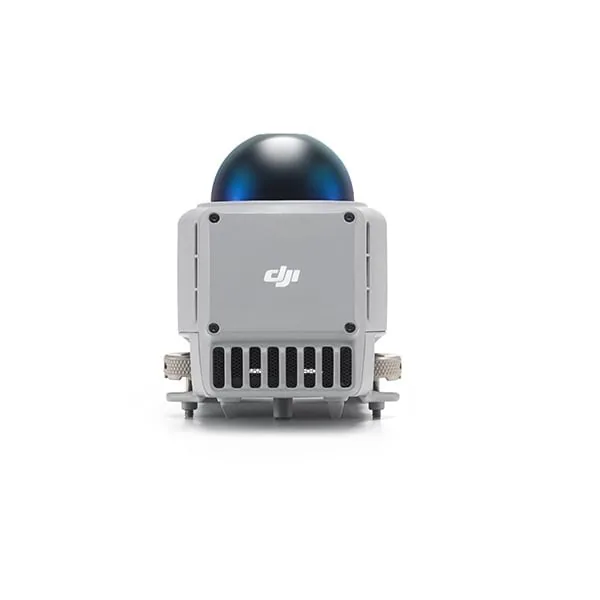
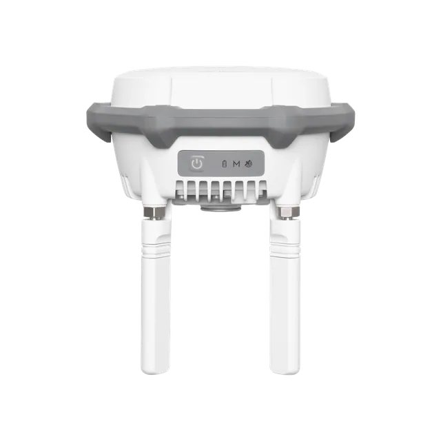
DJI D-RTK 3 Multifunctional Station
DJI multifunctional GNSS station that delivers centimeter-level RTK corrections to multiple drones at the same time, or extends the operating range in relay station mode. Thanks to Rover Station mode, with the DJI Enterprise app and DJI Terra, it also becomes a tool for high-precision aerial surveying. Designed for professional operators and surveying teams.
- 24-month statutory warranty of conformity and official DJI warranty
- Insured shipping, free over € 1,999 (parcels up to 50 kg) · Pick-up at our premises in Brindisi
- 14-day right of withdrawal for private customers
- Technical support in our workshop
Description
One station, three working modes
The D-RTK 3 Multifunctional Station integrates high-performance antennas and receiver modules, capable of tracking and resolving data from the main global satellite navigation systems. It supports multiple data transmission links and analyzes position and orientation thanks to a built-in high-performance inertial measurement unit (IMU).
It can work as a base station to provide centimeter-level positioning to multiple drones at the same time, or as a relay station to extend the operating range of the radio link. Rover Station mode, combined with the DJI Enterprise app and DJI Terra, completes the picture with a solution for aerial surveying and high-precision ground point measurement.
Complete GNSS coverage
- GPS: L1C/A, L2C, L5
- BDS: B1I, B2I, B3I, B1C, B2a, B2b
- Galileo: E1, E5a, E5b, E6
- GLONASS: L1, L2
- QZSS: L1C/A, L2C, L5
- L-Band
Accuracy in Rover mode
In static measurement, the D-RTK 3 claims a horizontal accuracy of 0.8 cm + 1 ppm (RMS) and a vertical accuracy of 1.5 cm + 1 ppm (RMS). Tilt measurement works in a range from 0° to 60°, with a horizontal accuracy of 8 mm + 0.7 mm per degree of tilt (under 2 cm within 30°). Values refer to normal conditions: unobstructed line of sight, good satellite distribution, low ionospheric activity and no electromagnetic interference or multipath effects.
Range in relay station mode
With no obstacles or interference, according to the CE standard the maximum distance is 8 km between aircraft and relay station and 300 m between relay station and remote controller (FCC: 15 km and 1 km; SRRC: 12 km and 1 km). For best results, the relay station should be placed in an elevated, unobstructed spot, so as to ensure clean communication between the remote controller and the aircraft.
Built for the field
With a 163 × 89 mm body (without OcuSync directional antennas), a weight of 1.26 kg and an IP67 protection rating (station only), the D-RTK 3 is designed for outdoor work. Always check that all the rubber port covers are correctly installed before use. For surveying, the D-RTK 3 Surveying Tripod and Pole Kit is available separately, designed to work together with the station.
In the box
| Qty | Item |
|---|---|
| 1 | D-RTK 3 Multifunctional Station |
| 4 | Spare OcuSync directional antennas |
| 1 | USB-A to USB-C data cable |
Contents verified against the manufacturer's official datasheet.
Technical data
| Operating modes | Base station (Broadcast), Relay station, Rover Station |
|---|---|
| GNSS frequencies | GPS: L1C/A, L2C, L5; BDS: B1I, B2I, B3I, B1C, B2a, B2b; Galileo: E1, E5a, E5b, E6; GLONASS: L1, L2; QZSS: L1C/A, L2C, L5; L-Band |
| Rover accuracy – static measurement | Horizontal 0.8 cm + 1 ppm (RMS); Vertical 1.5 cm + 1 ppm (RMS) |
| Rover accuracy – tilt measurement | Range 0°–60°; horizontal 8 mm + 0.7 mm/° of tilt (<2 cm within 30°) |
| Max distance in relay mode (CE) | 8 km between aircraft and relay station; 300 m between relay station and remote controller |
| Max distance in relay mode (FCC) | 15 km between aircraft and relay station; 1 km between relay station and remote controller |
| Max distance in relay mode (SRRC) | 12 km between aircraft and relay station; 1 km between relay station and remote controller |
| Ingress protection rating | IP67 (station only) |
| Dimensions | 163 × 89 mm (without OcuSync directional antennas) |
| Weight | 1.26 kg |
| Compatibility as stated on the official page | DJI Matrice 4D Series, DJI Matrice 4 Series |
| IMU | Integrated high-performance inertial measurement unit for position and orientation |
Frequently asked questions
What is the difference between base station mode and relay station mode?
In base station mode, the D-RTK 3 transmits RTK corrections for centimetre-level positioning of multiple drones at the same time. In relay station mode, it instead acts as a radio bridge between the aircraft and the remote controller, extending the operating range: with CE standard, up to 8 km between aircraft and relay and 300 m between relay and remote controller.
Can I use it to survey ground points like a surveying GNSS receiver?
Yes. Rover Station mode, combined with the DJI Enterprise app and DJI Terra, enables high-precision surveys: 0.8 cm + 1 ppm horizontally and 1.5 cm + 1 ppm vertically (RMS) in static measurement, with support for tilted measurement up to 60°.
Are the tripod and survey pole included?
No. The package contains the station, four spare OcuSync directional antennas and a USB-A to USB-C cable. The D-RTK 3 Tripod and Survey Pole Kit, designed to work together with the station, is sold separately.
Which drones is it compatible with?
The official product page lists compatibility with the DJI Matrice 4 Series and the DJI Matrice 4D Series. For other enterprise models, contact us: we will check compatibility together for the way you intend to use it.
Can it be used outdoors in bad weather?
The station has an IP67 protection rating (station only). It is important to check that all the rubber covers of the interfaces on the body are properly installed before field use.
Legal guarantee
As a consumer you are entitled by law to the legal guarantee of conformity for at least 2 years from delivery, for any defect present at the time of delivery (Italian Consumer Code, arts. 128 et seq.). The seller is directly liable for it. Any commercial warranties from the manufacturer are in addition to, and do not limit, the legal guarantee. Details and how to claim it.
You might also like
Have questions about this product?
Ask the people who use and repair it every day. We usually reply within one business day.
€ 1.613,00